Triglavski narodni park trailrunning round

This summer I decided to do a longer run (cca 50km with cca 2800m of altitude gain) starting and ending at lake Bohinj (campsite Zlatorog) running up to Triglavska Jezera Valley, via Koca pri Savici, stopping at Planika (the last mountain refuge before Triglav) and returning via Vodnikov dom and Korita Mojstrice.
GPS track: Here

The run takes you on a route many hikers will do in two to three days, passing some of the most beautiful parts of this mountain paradise – the 880km2 large Triglav National Park in the north west of Slovenia. The terrain is varied, often very technical and at times requires scrambling and using metal bars and lines put in place for safety. I didn’t use any via ferrata or self-belaying gear, but some hikers might want to.
After starting from the campsite Zlatorog (530m), I made my way up the very steep slope next to waterfall Savica to the plateau of Triglavska lakes (Dolina Triglavski Jezer – 1500m). This was the toughest (most technical and tricky) part of the run as there are many points where one needs to scramble up rocks or hold onto safety equipment.


Once at the top of Dolina Triglavskih Jezer (Triglav lake plateau), the adventure continues through beautiful easy woodland trails, passing huge rock formations above you, meadows full of summer flowers and gorgeous high mountain lakes.


There are plenty of places to refuel and stock up on fresh water and the refuges (Koca pri Triglavskih Jezerih, Zasavska Koca) are very close to each other (less than an hour’s run apart).

Zasavska Koca refuge (at the top of the trail)
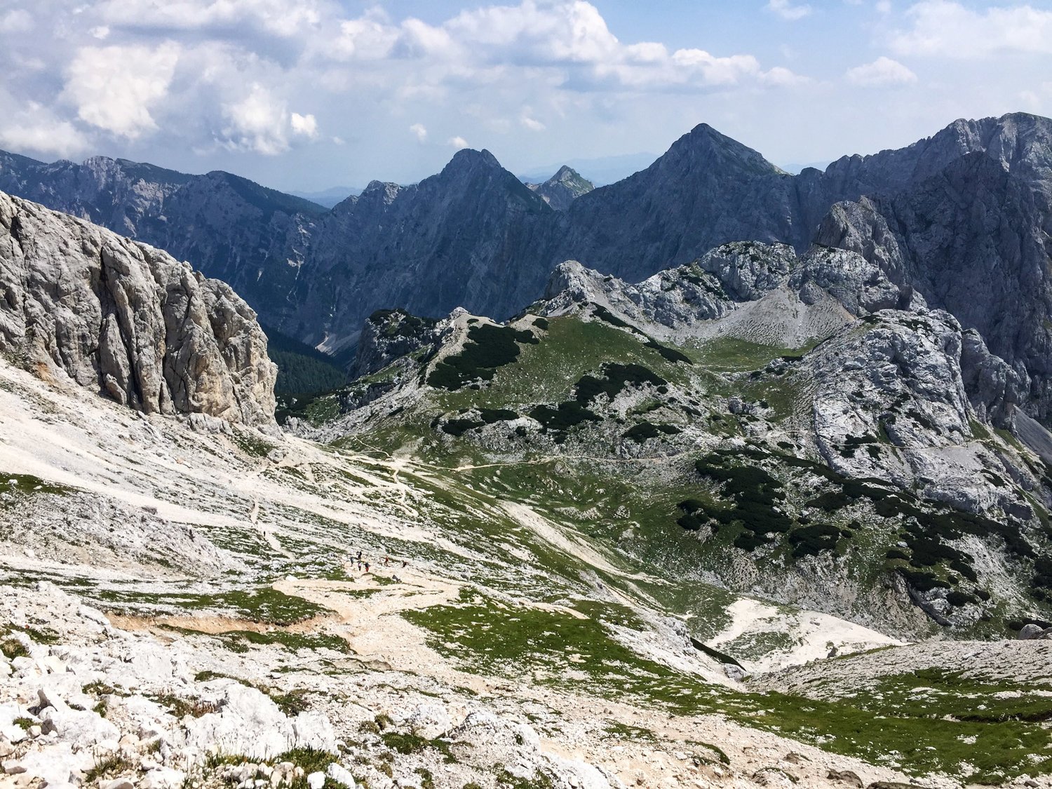
After Zasavska koca refuge, the trail becomes steep, technical and rocky. Climbing up a scree, you get to what feels like a mountain pass (between Kanjavec, and Vrh Hribaric) crossing the ‘lunar’ landscape before you embark on an epic descend down another scree with some amazing view of the world below.

‘Tiny’ hikers get lost in the middle of the frame


Short lived descend to Koca na Dolicu is then followed by a small very technical part just before you reach Planika. Above you, you can see Triglav, the tallest peak in Slovenia.


From here, it’s all downhill (•
First you pass Vodnikov Dom and then get down to the valley of Mojstrica quite quickly. Worth taking a short detour, is the small waterfall at the end of the valley and the pools of Mojstrica river/stream.

Full of fresh, cold water from Mojstrica, I felt like doing a bit more running so I made my way up Planina Spodnji Vogar for a view of Lake Bohinj and a quick picture. Then I made my way along the lake (north side) back to the camp.


Beautiful, but tough run that I would definitely recommend for any sky-runners out there. Worth doing it on a warm day (it was 33º in the valley and 17º in the mountains), as the temperature at the top will be perfect.